What Different World Maps Get Right - and What They Get Wrong
The 164-1 vote urges governments, schools and tech companies to use equal-area maps that show Africa’s size more accurately.
- On Friday, the United Nations General Assembly adopted a non-binding resolution led by Togo and backed by the African Union, passing by a vote of 164-1 to encourage more accurate world maps.
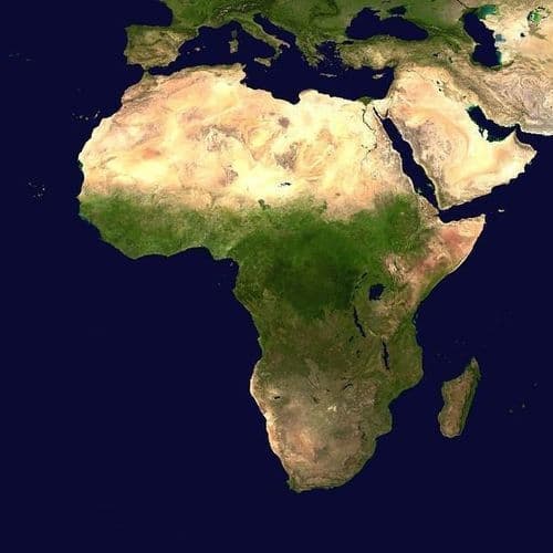
- The 1569 Mercator projection, created by cartographer Gerardus Mercator, distorts landmass sizes by enlarging areas far from the Equator, making Greenland appear similar to Africa despite the continent being about 14 times larger.
- Togolese Foreign Minister Robert Dussey emphasized that African nations seek scientific recognition, not special treatment: "We are not asking for a privilege. We just want to have the real size that we have in the world in terms of geography."
- The United States stood alone as the only nation voting against the resolution, with U.S. officials characterizing the initiative as promoting an ideological agenda that distracts from pressing international issues.
- While the resolution does not ban the Mercator projection, it encourages schools, technology companies, and international organizations to use equal-area maps like The Equal Earth, which the African Union adopted for its 54 member states earlier this year.
30 Articles
30 Articles


Correcting the map: How a UN resolution marks a step toward decolonizing world maps
Some countries and territories, including Canada, Greenland and Russia, will soon look notably smaller on official United Nations maps. That is due to a recent resolution adopted by the UN General Assembly: “Correct the map: rebalancing global cartographic representation and promoting equitable representation of the world’s regions, particularly Africa.” This resolution, led by Togo on behalf of the African Union, repairs 450 years of cartograph…

For centuries, the projection of Mercator has dominated our way of visualizing the world, but it has also distorted the relative size of continents. Africa is one of the great examples: its surface appears much smaller than it really is in front of Europe and other regions of the planet. A new cartographic model seeks to correct these proportions and offer a more faithful representation of the size of the territories. What changes in our view of…

The initiative was promoted by the African Union in order to promote the use of a more accurate cartographic projection on the world The post This is the UN-approved world map showing the real size of continents appeared first on Rolling Stone in Spanish.


African Union countries have long complained that their continent is not realistically depicted on maps. The UN General Assembly wants to change this…
Coverage Details
Bias Distribution
- 40% of the sources lean Left, 40% of the sources are Center


Factuality
To view factuality data please Upgrade to Premium