Trump posts map with American flag emblazoned over Canada, Greenland, Mexico
- On Monday, President Donald Trump shared an AI-generated map on Truth Social depicting a vastly expanded United States encompassing Canada, Mexico, Greenland, and other North American territories without providing caption or policy context.
- Trump's map aligns with a pattern of recent territorial provocations, including suggestions that Canada become the 51st U.S. state and his declarations renaming the "Gulf of America" and "Lake America" amid escalating trade disputes.
- The map encompasses 23 sovereign nations and Caribbean territories. Craig Agranoff, a political professor at Florida Atlantic University, told Newsweek the image appears "more like messaging than a policy memo."
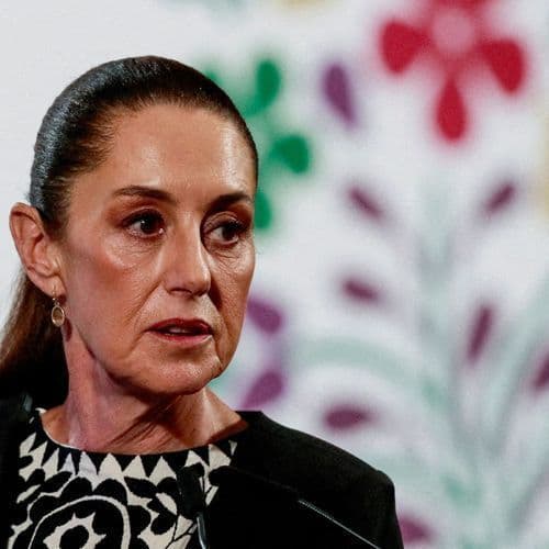
- President Claudia Sheinbaum defended Mexico's sovereignty on Monday, stating the nation is not a "colony or protectorate of any foreign country" and reaffirming Mexico as "free, independent, and sovereign."
- Foreign Minister Bruno Rodríguez also pushed back, accusing the United States of subjecting the Cuban people to "collective punishment" through intensified sanctions and energy blockades limiting Cubans to two or three hours of electricity daily.
386 Articles
386 Articles

World politics is buzzing about a map shared by US President Donald Trump on his social media account, Truth Social. Trump, with a single image, erased neighboring countries from the map, causing an uproar worldwide.


On his social network, Donald Trump has published a false map of the United States on which the American flag covers other countries such as Canada, Greenland, Mexico and even the French Antilles. What could arouse the anger of some of the states concerned and revive the debate on the president's mental health, faced with the frenzy with which he publishes false visuals.

Trump's new provocation. The US President has released a draping map of the American symbol Canada, Mexico, the Caribbean and Iceland. Donald Trump has just triggered a new

Trump's new provocation comes from a map. The American president has published on Truth Social an image in which the flag of the United States covers Canada, Mexico, Greenland, Iceland, part of Central America and the Caribbean, including Cuba. The post, spread without explanation, rekindles the controversy over the territorial ambitions already expressed by tycoon, from Greenland to Canada. On La Stampa: Greenland that does not review itself in…
Coverage Details
Bias Distribution
- 50% of the sources are Center


![[your]NEWS](/_next/image?url=https%3A%2F%2Fgroundnews.b-cdn.net%2Finterests%2Ffb6dc495f74049f513563c33352175eaa0ecd509.jpg%3Fwidth%3D60&w=128&q=75)


Factuality
To view factuality data please Upgrade to Premium