Published • loading... • Updated
Karina strengthens into a Category 4 hurricane in the Pacific far from land, forecasters say
The storm reached 145 mph winds, forecasters said, while swells could bring dangerous surf and rip currents to Mexico and Southern California.
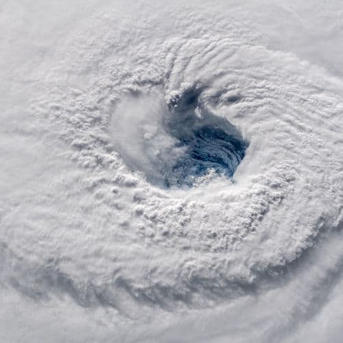
- On Sunday, Hurricane Karina strengthened rapidly into a dangerous Category 3 storm in the Pacific Ocean, intensifying from 80 mph winds to 125 mph within hours, according to the National Hurricane Center in Miami.
- Meteorologists reported the storm organized much faster than expected over just a few hours, as Karina moved over very warm sea surface temperatures near 29°C in an environment highly conducive to further intensification.
- Centered about 960 miles west-southwest of Mexico's Baja California Peninsula and moving west at around 9 mph, Karina maintains top sustained winds of 125 mph with even stronger gusts.
- Despite no coastal warnings in effect, forecasters warned the powerful system is already pushing large ocean swells toward southwest Mexico and the Baja California Peninsula, creating dangerous surf and life-threatening rip currents over the next couple of days.
- Karina could strengthen further with peak winds potentially reaching 140 mph before gradually weakening later in the week, while Tropical Storm Lowell positioned about 985 miles east-southeast of Hilo, Hawaii, may become a hurricane by Monday night or Tuesday.
Insights by Ground AI
163 Articles
163 Articles

NHC expects between 5 and 13 tropical storms to occur in the Central Pacific between 1 June and 30 November, following extraordinary water warming caused by the El Niño phenomenon.
·Caracas, Venezuela (Bolivarian Republic of)
Read Full Article
Hurricane Karina reaches category 4 in the Pacific; authorities rule out risk for Mexico although it is expected to swell in the region.


A large hurricane is category 3 or higher, with sustained maximum winds of at least 178 km/h (111 mph)


During the early hours of Monday, August 31, Hurricane "Karina" intensified to category 4; what effects does it generate in Mexico and what is its trajectory?

Coverage Details
Total News Sources163
Leaning Left39Leaning Right12Center78Last UpdatedBias Distribution61% Center
Bias Distribution
- 61% of the sources are Center
61% Center
L 30%
C 61%


Factuality
To view factuality data please Upgrade to Premium