Published • loading... • Updated
Rare Train of Pacific Cyclones Fueled by Historic El Niño
NOAA says the rare cluster of Pacific cyclones could intensify rainfall and winds across the region as El Nino nears its peak.
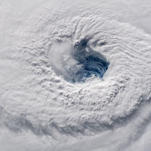
- On Wednesday, September 2, 2026, a National Oceanic and Atmospheric Administration satellite image captured a rare train of three storms across the Pacific Ocean: Hurricane Lowell, Hurricane Karina, and Tropical Storm Marie.
- El Niño, the warming phase of the ENSO cycle, fuels these storms with warm waters; climate scientist Julia Cole of the University of Michigan told AFP a three-cyclone train is "definitely rare to see."
- Both Category 4 storms are anticipated to pass near Hawaii with potential for gusty trade winds and increased rainfall, while Tropical Storm Marie is "expected to become a hurricane later today," the National Hurricane Center said.
- This year's El Niño has a 69 percent chance of becoming the strongest on record, echoing 2015 when four cyclones including Hurricane Ignacio and Hurricane Jimena tracked across the Pacific simultaneously.
- Greenhouse gases hold more moisture, intensifying El Niño-linked rains; however, consensus remains limited on whether climate change triggers stronger El Niños, according to recent research published in Science.
Insights by Ground AI
63 Articles
63 Articles


Three Simultaneous Cyclones Are Formed in the Pacific, Boosted by the Exceptional Episode of El Niño
As Hawaii recovers from Hurricane Lala, which hit it in mid-August, three close cyclones cross the Great Ocean at the same time. A particularly rare phenomenon, amplified by global warming.
·Paris, France
Read Full Article
According to the World Meteorological Organization, the El Niño phenomenon is expected to be "very intense" over the next five months.
·Rennes, France
Read Full Article

Three cyclones have been crossing the Pacific since Wednesday at the same time, as the United Nations anticipates a "very high intensity" El Niño for the coming months.
·Paris, France
Read Full ArticleCoverage Details
Total News Sources63
Leaning Left6Leaning Right10Center13Last UpdatedBias Distribution45% Center
Bias Distribution
- 45% of the sources are Center
45% Center
L 21%
C 45%
R 34%


Factuality
To view factuality data please Upgrade to Premium